La Vecquée


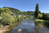
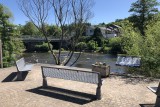
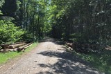
Passing through towns and small villages, a lake and preserved nature, this two-day bike ride has something for everyone. Starting from Trois-Ponts station, take the RAVel to reach the towns of Stavelot and Malmedy. Discover these towns, which are rich in tradition, through the cathedral, abbey, monastery, museums, and kiosks. Next, cycle towards Waimes, which has brasseries and restaurants that are perfect for a break. The journey continues towards Bütgenbach and its famous lake. This resort-like village reveals unspoiled nature, large forests, vast green expanses, magnificent bocages, and nature reserves that are worthy of preservation. From Bütgenbach to Hockai, there are many options for an overnight stay.
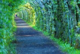
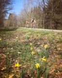
The bike ride continues towards the Fens and Signal de Botrange, the highest point in Belgium. It then joins the bower, the longest plantation in Europe, which forms an arch. Your bike ride finishes by passing through the charming villages of Deigné and Remouchamps, before arriving at Aywaille station.
Eat and drink: there are many places to eat and drink along the route.
Plan your stay: www.ostbelgien.eu
- Difficulty: Medium
- Elevation: 833 m E+ and 961 m E-
- Distance: 102 km
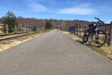
- Starting point: Trois-Points station
- Node points to follow: 1 → 2 → 3 → 7 → 8 → 9 → 10 → 11 → 12 → 14 → 15 → 16 → 17 → 18 → 17 → 16 → 15 → 14 → 46 → 5 → 44 → 43 → 79 → 80 → 51 → 52 → 50 → 76 → 75 → 74 → 73 → 18 → 17 → 16 → 15 → 14 → 13 → 12 → 11 → 8 → 7 → 6 → 5 → 46 → 45
- End point: Aywaille station
- Bed & Bike accommodation: www.ostbelgien.eu
Itinéraire

 Departure/Arrival
 Point of interest
Circuit n° 1
Nodes to follow1 → 2 → 3 → 7 → 8 → 9 → 10 → 11 → 12 → 14 → 15 → 16 → 17 → 18 → 17 → 16 → 15 → 14 → 46 → 5 → 44 → 43 → 79 → 80 → 51 → 52 → 50 → 76 → 75 → 74 → 73 → 18 → 17 → 16 → 15 → 14 → 13 → 12 → 11 → 8 → 7 → 6 → 5 → 46 → 45
 |
- Difficulty :
- Medium
- Height variation :
- 833 D+ m / 961 D- m
- Distance :
- 102 kms
- Departure :
- Lieu de départ Trois-Ponts