Hesbaye Basse-Meuse and Geer


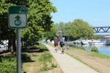
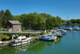
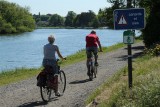
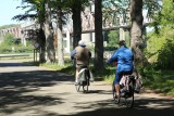
Starting from Pont Atlas on the outskirts of Liège, you will take the RAVel network along the Meuse river and the Albert canal towards Maastricht. Once you reach Lanaye, you will follow the locks, which form a junction between different canals close to the Dutch border, to reach Eben-Emael and its famous fortress – the largest fortified area in Liège! – which was seized in May 1940 and... is still open to visitors. Next comes the village of Wonck and its caves, which are particularly popular during the Christmas period. The end of the route will take you to Thier-à-Liège, an authentic green belt located a stone’s throw from Liège city center, for a gentle descent towards your starting point.
- Difficulty: Medium
- Elevation: 127 m
- Distance: 53 km
- Starting point: Quai de Wallonie – 4000 Liège
- Nodes to follow: 31 → 30 → 17 → 44 → 45 → 46 → 47 → 40 → 14 → 13 → 16 → 5 → 32 → 7 → 10 → 19 → 18 → 23 → 22 → 27 → 38 → 31
- Download the walk
Itinéraire

 Departure/Arrival
 Point of interest
Circuit n° 1
Nodes to follow31 → 30 → 17 → 44 → 45 → 46 → 47 → 40 → 14 → 13 → 16 → 5 → 32 → 7 → 10 → 19 → 18 → 23 → 22 → 27 → 38 → 31
- Difficulty :
- Medium
- Height variation :
- 127 m
- Distance :
- 53 kms
- Departure :
- Lieu de départ Liège