Ommerscheider forest


Looking for tranquility, fresh air, and breathtaking views, but without too much altitude? Then this magnificent itinerary through Ommerscheider forest is for you.
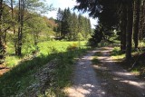
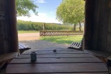
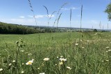
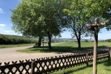
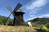
The ride starts with a rather steep climb to reach the hills of Schönberg. Continue – without too much difficulty – through the woods to arrive in the peaceful village of Meyerode. A breathtaking view spreads out before you. Use the shed for a short break (leave it as you found it).
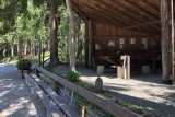
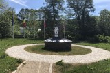
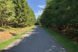
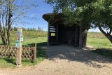
After passing through the village, join the road to Ommerscheider forest. You’ll pass the memorial to Eric Fisher Wood, a young soldier who lost his life in 1945, at the age of 26, by fighting some German troops alone. Along the way, there is a covered rest area where you can comfortably enjoy this idyllic area in the heart of nature.
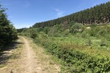
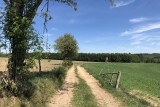
Next, follow the water by gently going down the path, before hitting a fairly steep hill. The rest of the bike ride is fairly easy, traveling along the water to Schönberg.
Eat and drink: in Schönberg and Meyerode
The ride starts with a rather steep climb to reach the hills of Schönberg. Continue – without too much difficulty – through the woods to arrive in the peaceful village of Meyerode. A breathtaking view spreads out before you. Use the shed for a short break (leave it as you found it).
After passing through the village, join the road to Ommerscheider forest. You’ll pass the memorial to Eric Fisher Wood, a young soldier who lost his life in 1945, at the age of 26, by fighting some German troops alone. Along the way, there is a covered rest area where you can comfortably enjoy this idyllic area in the heart of nature.
Next, follow the water by gently going down the path, before hitting a fairly steep hill. The rest of the bike ride is fairly easy, traveling along the water to Schönberg.
Eat and drink: in Schönberg and Meyerode
- Difficulty: Difficult
- Elevation: 337 m
- Distance: 21 km
- Starting point: In der Trot, Schönberg - Saint-Vith
- Node points to follow: 41 → 13 → 37 → 40 → 44 → 43 → 42 → 41
- Download the walk
Itinéraire

 Departure/Arrival
 Point of interest
Circuit n° 1
Nodes to follow41 → 13 → 37 → 40 → 44 → 43 → 42 → 41
 |
- Difficulty :
- Difficult
- Height variation :
- 337 m
- Distance :
- 21 kms
- Departure :
- Lieu de départ Saint-Vith