Pays des Sources itinerary


Itinerary reserved for athletes or electric bikes
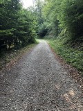
Upon leaving Theux, you will join Point-nœud 43 and tackle your first challenge of the day: the climb towards the hamlets of Hodbomont and Jevoumont. Once you reach the summit, you will realize that the beautiful panorama over the surrounding countryside was worth the trouble.
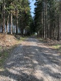
At Point-nœud 13, you will find La Charmille du Haut Marêt, a stunning 573-meter tunnel of trees! It is known as the largest – and one of the most beautiful – in Europe. No fewer than 4,700 hornbeam plants form this arched tunnel, with nearly 70% of them being one hundred years old. Inside, you will be able to stroll around… on foot.
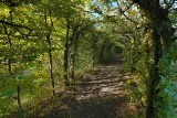
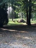
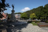
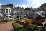
After passing through Vert-Buisson, a small hamlet that has preserved a rare example of rural archeology, you will head towards Spa, the jewel of the Ardennes and the birthplace of thermal baths. It is listed as a UNESCO World Heritage Site. While this thermal city is known for culture, you will soon discover that it is also overflowing with nature and punctuated with varied landscapes and a number of streams.
Finally, you will join the RAVeL network and slowly descend along Bois de Staneux towards your starting point.
If you’re a history buff, don’t hesitate to leave your bike at Point-nœud 65 and join the pedestrian trail towards Franchimont Castle: a tour, museum, boutique, and café await you there. You can also reach the castle by bike via Rue du Pré de l’Evêque (warning: it’s steep).
You can also rent bikes from the tourist information office in Theux.
Upon leaving Theux, you will join Point-nœud 43 and tackle your first challenge of the day: the climb towards the hamlets of Hodbomont and Jevoumont. Once you reach the summit, you will realize that the beautiful panorama over the surrounding countryside was worth the trouble.
At Point-nœud 13, you will find La Charmille du Haut Marêt, a stunning 573-meter tunnel of trees! It is known as the largest – and one of the most beautiful – in Europe. No fewer than 4,700 hornbeam plants form this arched tunnel, with nearly 70% of them being one hundred years old. Inside, you will be able to stroll around… on foot.
After passing through Vert-Buisson, a small hamlet that has preserved a rare example of rural archeology, you will head towards Spa, the jewel of the Ardennes and the birthplace of thermal baths. It is listed as a UNESCO World Heritage Site. While this thermal city is known for culture, you will soon discover that it is also overflowing with nature and punctuated with varied landscapes and a number of streams.
Finally, you will join the RAVeL network and slowly descend along Bois de Staneux towards your starting point.
If you’re a history buff, don’t hesitate to leave your bike at Point-nœud 65 and join the pedestrian trail towards Franchimont Castle: a tour, museum, boutique, and café await you there. You can also reach the castle by bike via Rue du Pré de l’Evêque (warning: it’s steep).
You can also rent bikes from the tourist information office in Theux.
- Difficulty: Difficult
- Elevation: 631 m
- Distance: 43,6 km
- Starting point: Rue Chinrue, 32 (or Rue de la Chaussée) - 4910 Theux.
For fans of Slow Tourism, you can return to the starting point via Theux train station. - Node points to follow: 64 → 43 → 9 → 8 → 11 → 12 → 13 → 14 → 58 → 67 → 69 → 23 → 22 → 94 → 95 → 66 → 65 → 64
- Download the walk
Itinéraire

 Departure/Arrival
 Point of interest
Circuit n° 1
Nodes to follow64 → 43 → 9 → 8 → 11 → 12 → 13 → 14 → 58 → 67 → 69 → 23 → 22 → 94 → 95 → 66 → 65 → 64
 |
- Difficulty :
- Difficult
- Height variation :
- 631 m
- Distance :
- 43,6 kms
- Departure :
- Lieu de départ Theux