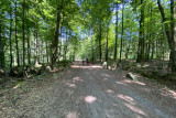
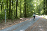
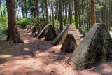
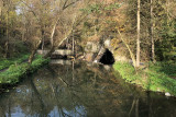
Preuss forest


This beautiful historical itinerary begins from Welkenraedt train station, which can be easily reached by car or train, and will take you across Germany and Belgium.
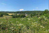
After stopping at the former Herbesthal train station, which was once considered to be among the most beautiful in Europe, you will cycle through bocage landscapes to the Preuss forest, which means ‘borders’, and which conceals fortifications from the 14th century and the Siegfried line (1938–39). You will then arrive at Three-Country Point, a symbol of the place where the borders of the Netherlands, Germany and Belgium meet. The King Baudouin Tower, which is 50 metres high, offers an exceptional panorama of the entire region, as well as a place to dine.
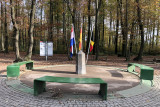
A fourth point is located a few metres away, which marked the Moresnet-Neutre territory. For decades, this tiny territory belonged to three countries, due to the zinc mine within it that each country claimed ownership over! Esperanto was even an official language there.
Next on the itinerary, the Museum of the Geul Valley in Kelmis, which recounts local history, a descent to Gemmenich, which was voted the best European greenway in 2021, via Line 39 of the RAVeL network, the mining site house in Plombières, the Calaminaire site and its cave, picnic areas and then a return to the point of departure.
Places to eat:
Points of interest en route:
Note:
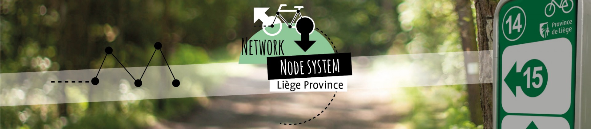
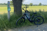
The ‘German points-nœuds’ are slightly different from those in the Province of Liège. Indeed, the number of the points-nœud is red and is at the top of a post with several direction markers. Below each direction marker, you will find the points-nœud numbers to follow. At each point where two points-nœuds intersect, you will find an unnumbered sign with a bicycle and a red arrow indicating the direction to follow.
After stopping at the former Herbesthal train station, which was once considered to be among the most beautiful in Europe, you will cycle through bocage landscapes to the Preuss forest, which means ‘borders’, and which conceals fortifications from the 14th century and the Siegfried line (1938–39). You will then arrive at Three-Country Point, a symbol of the place where the borders of the Netherlands, Germany and Belgium meet. The King Baudouin Tower, which is 50 metres high, offers an exceptional panorama of the entire region, as well as a place to dine.
A fourth point is located a few metres away, which marked the Moresnet-Neutre territory. For decades, this tiny territory belonged to three countries, due to the zinc mine within it that each country claimed ownership over! Esperanto was even an official language there.
Next on the itinerary, the Museum of the Geul Valley in Kelmis, which recounts local history, a descent to Gemmenich, which was voted the best European greenway in 2021, via Line 39 of the RAVeL network, the mining site house in Plombières, the Calaminaire site and its cave, picnic areas and then a return to the point of departure.
Places to eat:
- Kockartz Bakeries
- Mannekenfrit
- Kukuk – CaféBar (de)
- Three-country point
- Taverne du Soleil – Plombières
- Welkenraedt centre
Points of interest en route:
- Preuss forest
- Moresnet-Neutre
- The three points
- The mining site in Plombières
- Difficulty: Medium
- Elevation: 427 m
- Distance: 49 km
- Starting point: Car park of Welkenraedt train station, Place de la Gare, 11 – 4840 Welkenraedt. It is easy to arrive by train from Aachen, Liège or Brussels
- Points-nœuds to follow: 12 → 21 → 33 → 45 → 31 → 95 → 19 → 18 → 17 → 37 (de) → 13 (de) → 14 (de) → 5 → 91 → 3 → 60 → 58 → 04 → 07 → 08 → 11 → 12
- Download the walk
Note:
The ‘German points-nœuds’ are slightly different from those in the Province of Liège. Indeed, the number of the points-nœud is red and is at the top of a post with several direction markers. Below each direction marker, you will find the points-nœud numbers to follow. At each point where two points-nœuds intersect, you will find an unnumbered sign with a bicycle and a red arrow indicating the direction to follow.
Itinéraire

 Departure/Arrival
 Point of interest
Circuit n° 1
Nodes to follow12 → 21 → 33 → 45 → 31 → 95 → 19 → 18 → 17 → 37 (de) → 13 (de) → 14 (de) → 5 → 91 → 3 → 60 → 58 → 04 → 07 → 08 → 11 → 12
 |
- Difficulty :
- Medium
- Height variation :
- 427 m
- Distance :
- 49 kms
- Departure :
- Lieu de départ Welkenraedt