The short High Fens circuit

  • RANDO-M - FR
  • RANDO-M - N
  • RANDO-M - DE
  • RANDO-M - EN
  • Cycling and hiking tours - The short High Fens circuit - Waimes - Signal de Botrange - Butte Baltia
  • Cycling and hiking tours - The short High Fens circuit - Waimes - Signal de Botrange - Map
  • Cycling and hiking tours - The short High Fens circuit - Routes - Fens
  • Cycling and hiking tours - The short High Fens circuit - Landscapes of Fens
  • Cycling and hiking tours - The short High Fens circuit - Landscapes of Fens
  • Cycling and hiking tours - The short High Fens circuit - Landscapes of Fens
Cycling and hiking tours - The short High Fens circuit - Waimes - Signal de Botrange - Butte BaltiaCycling and hiking tours - The short High Fens circuit - Waimes - Signal de Botrange - MapCycling and hiking tours - The short High Fens circuit - Routes - FensCycling and hiking tours - The short High Fens circuit - Landscapes of FensCycling and hiking tours - The short High Fens circuit - Landscapes of FensCycling and hiking tours - The short High Fens circuit - Landscapes of Fens
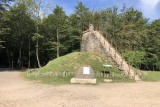
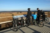
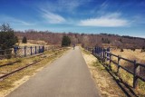
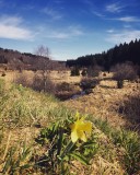
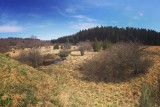
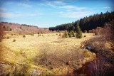
Departing from Maison du Parc Naturel de Botrange, cycle towards Sourbrodt to join the Vennbahn section of the RAVeL. Leave this to enter a remarkable beech forest. The route continues through fens and forests to reach Signal de Botrange, the highest point in Belgium.

Eat and drink: in Botrange

  • Difficulty: Easy
  • Elevation: 216 m
  • Distance: 20 km
  • Starting point: Maison du Parc Naturel (Route de Botrange, 131 - 4950 Waimes)
  • Node points to follow: 50 → 51 → 80 → 79 → 43 → 42 → 86 → 83 → 80 → 51 → 52 → 50
  • Download the walk
Itinéraire
loading
- Departure/Arrival
- Point of interest
Circuit n° 1
Nodes to follow50 → 51 → 80 → 79 → 43 → 42 → 86 → 83 → 80 → 51 → 52 → 50
  • Difficulty :
    • Easy
  • Height variation :
    • 216 m
  • Distance :
    • 20 kms
  • Departure :
    • Lieu de départ Waimes