Via Jecore ‘All by bike’


PLEASE NOTE, THIS RIDE IS NOT ACCESSIBLE DURING OR AFTER HEAVY RAIN. THE SMALL TRACK ALONG THE GEER FROM LENS-SAINT-REMY TO HOLLOGNE-SUR-GEER MAY BE INACCESSIBLE.
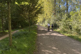
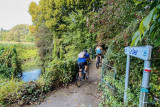
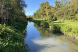
This ride takes you through the picturesque Geer Valley and its green landscapes from its source to Lens-Saint-Remy. This charming village is known for its listed site and ‘Carmel’ founded in 1343 and rebuilt in 1715.
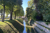
After pedalling on the path along the Geer for 6 km, you’ll reach the Haut-Geer Nature Reserve. Formed from old settling ponds, this location is a small paradise for the birds of Hesbaye and one of the most beautiful bird-watching sites in Wallonia. A few kilometres from here is the fascinating world of insects that you can discover at the Jean Leclercq Insectarium (Hexapoda).
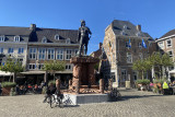
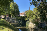
Then pedal towards Tongres and Maastricht, the oldest towns in Belgium and the Netherlands, linked in the past since the Roman era. On the way, you’ll come across several curiosities: the Broukay windmill, the Eben-Ezer Tower which overlooks the Geer Valley with its concrete sculptures of winged creatures, Eben fort and Saint-Pieter fort, the Marnes caves as well as the ENCI area a little before Maastricht.
There are several options suggested for this ride:
Types of bicycle:
 All road All terrain Electric
 Racing Urban Tandem Kids’ trailers

This ride takes you through the picturesque Geer Valley and its green landscapes from its source to Lens-Saint-Remy. This charming village is known for its listed site and ‘Carmel’ founded in 1343 and rebuilt in 1715.
After pedalling on the path along the Geer for 6 km, you’ll reach the Haut-Geer Nature Reserve. Formed from old settling ponds, this location is a small paradise for the birds of Hesbaye and one of the most beautiful bird-watching sites in Wallonia. A few kilometres from here is the fascinating world of insects that you can discover at the Jean Leclercq Insectarium (Hexapoda).
Then pedal towards Tongres and Maastricht, the oldest towns in Belgium and the Netherlands, linked in the past since the Roman era. On the way, you’ll come across several curiosities: the Broukay windmill, the Eben-Ezer Tower which overlooks the Geer Valley with its concrete sculptures of winged creatures, Eben fort and Saint-Pieter fort, the Marnes caves as well as the ENCI area a little before Maastricht.
There are several options suggested for this ride:
- The two-day version with a night in Maastricht (139 km)
- The alternative over three days with a night in Tongres and a night in Maastricht (139 km)
Types of bicycle:
- Difficulty: Easy
- Elevation: 382 m
- Distance: 139 km
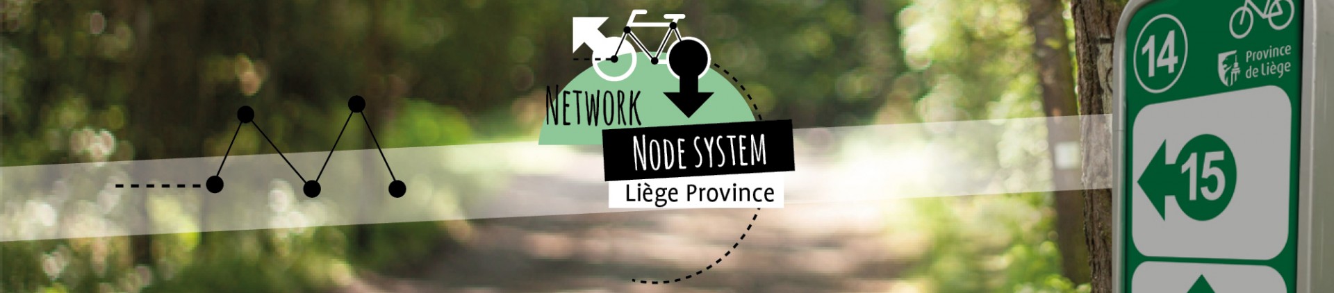
- Starting/end point: Lens-Saint-Rémy (at point-nœud 27 which is behind the Lens-Saint-Remy church by Carmel).
You’ll find several parking spaces near the church or cemetery - Points-nœuds to follow: 27 → 28 → 30 → 32 → 34 → 35 → 36 → 15 → 50 → 51 → 52 → 53 → 54 → 127 → 556 → 118 → 115 → 116 → 111 → 112 → 114 → 9 → 7 → 32 → 5 → 402 → 401 → 12 → 3 → 1 → 3 → 11 → 88 → 124 → 540 → 81 → 89 → 86 → 113 → 112 → 111 → 116 → 115 → 118 → 556 → 127 → 54 → 53 → 52 → 51 → 50 → 15 → 36 → 35 → 34 → 32 → 30 → 28 → 27
Itinéraire

 Departure/Arrival
 Point of interest
Circuit n° 1
Nodes to follow
27 → 28 → 30 → 32 → 34 → 35 → 36 → 15 → 50 → 51 → 52 → 53 → 54 → 127 → 556 → 118 → 115 → 116 → 111 → 112 → 114 → 9 → 7 → 32 → 5 → 402 → 401 → 12 → 3 → 1 → 3 → 11 → 88 → 124 → 540 → 81 → 89 → 86 → 113 → 112 → 111 → 116 → 115 → 118 → 556 → 127 → 54 → 53 → 52 → 51 → 50 → 15 → 36 → 35 → 34 → 32 → 30 → 28 → 27
 |
- Difficulty :
- Easy
- Height variation :
- 382 m
- Distance :
- 139 kms
- Departure :
- Lieu de départ Lens-Saint-Rémy